Markers and images
Markers represent Object records with a usable Location. Their positions come from data; their default appearance belongs to Marker → Settings.
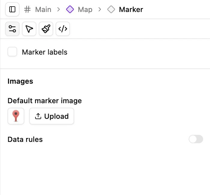
Set the default image
Section titled “Set the default image”- Select Marker under Map in the component tree.
- Click the square image selector to choose an existing marker image.
- Or use Upload to add a new image.
- Check the preview at the intended map scale.
The image button shows the marker itself instead of a long filename. Choose a file with suitable transparency and a size appropriate for the design.
Choose images by field value
Section titled “Choose images by field value”Use the Marker data-rule controls to select an Object field, including supported nested fields. Load its available values and choose an image for each value.
Label/value rows come from the selected field and are read-only here. Change labels or choices in the Collection field definition. Rows without an explicit image use the default marker image, so updating that default can affect many markers.
If you remove a mapping, the corresponding records can return to the inherited default rather than disappearing.
Set positions
Section titled “Set positions”Open the Objects Collection in Database and edit a record’s Location. Use valid geographic coordinates or the supported address workflow for calibrated maps. The record can also have a custom marker image where the Location form supports it.
Do not add Location to Regions. Region geometry comes from SVG; markers come from Objects.
Interactions and troubleshooting
Section titled “Interactions and troubleshooting”Configure hover/click actions in Marker → Interactions. Use Arrow mode to test. A missing marker can mean the Query omitted Location, the coordinates are outside the current view, the record is filtered out, or the image URL is unavailable.
First confirm the record appears in the Page’s Objects Query. Then inspect Location and image selection. Changing the default marker image cannot repair an incorrect binding.
Clustering, when installed, is configured under Map and applies to markers rather than SVG regions.