Perfect WordPress map plugin for any project
- Sales Reps
- Store Locator
- Land plots
- Data Visualization
Display your sales representatives on a map, each on the region they represent. Add info on their profile so the prospects will gain their trust. There’s nothing better than improving your deals closing rate with a few simple tweaks to your site.
MapSVG is the perfect WordPress map plugin for brick and mortar shops that show the customer where their physical locations are placed.
Impress your site visitors with an aerial view of the neighborhood. Use image maps to your advantage and improve your website’s functionality.
Convert your numbers to colors on the map. Show statistical information and visualize your data.
Turn any image into an interactive map
Add an overlay on Google Map
Add interactivity to a jpeg/png image
Load data from any source
 MapSVG Database
 WordPress Custom Posts
 WooCommerce Products
 Advanced Custom Fields
 Any API endpoint
 Google Sheets coming soon
- Filters
- Text search
- Pagination
- Modify search query before sending it to the server
- Modify data received from the server
- Connect fields to marker images
- Connect fields to regions colors
Manage data and maps in one place
- People
- Shops
- Restaurants
- Sales representatives
- Events
- Real estate properties
- Anything else
Link objects to map regions
Map regions can have one or more objects that you've created. Show the list of connected objects on click on a region.
Show locations on the map
Custom objects can have an address field that gets converted to geo-coordinates.
Show a list of objects with filters
Add a directory next to your map, with filters and text search field.
Powerful map editing tools
- SettingsControl the general map settings – the size, initial position, tooltips, and others.
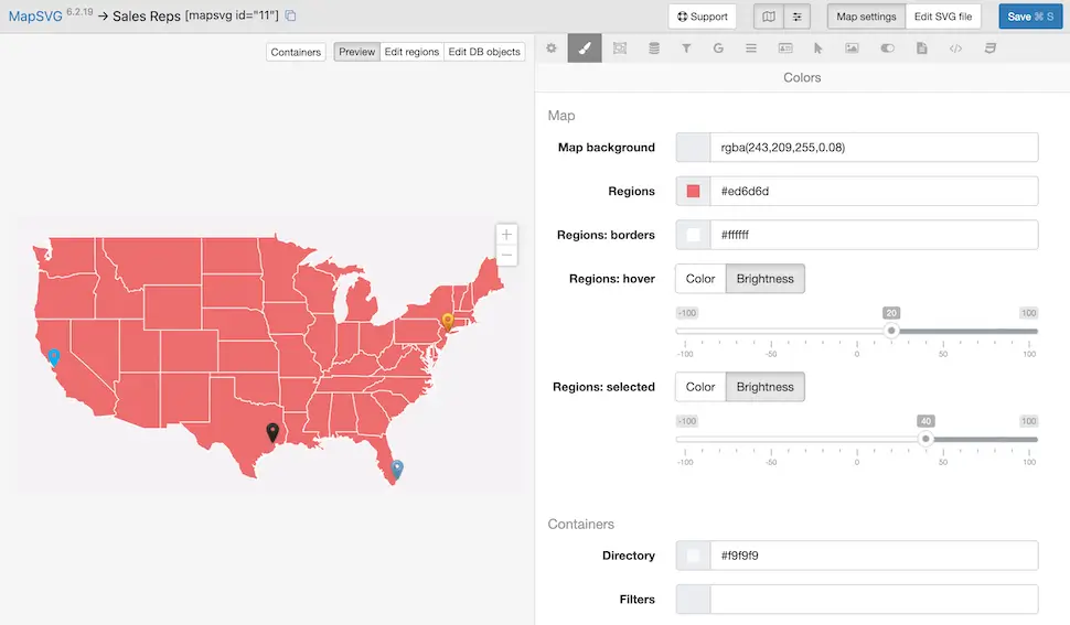
- ColorsEdit the colors of your map regions and containers’ colors.
- RegionsControl map regions: add custom fields, set region statuses, colors, import data from a CSV file.
- DatabaseCreate and manage custom objects. Attach objects to map regions. Import data from a CSV file.
- FiltersAdd filters and text search for your database items.
- Google MapsEnable Google Maps. Add custom Google Map styles from SnazzyMaps.
- DirectoryAdd a list of your objects (or list of map regions) near the map.
- Details ViewControl the settings of "Details view" - the large scrollable window that appears on click on a region or marker.
- ActionsSet up actions when clicking on a region, marker, or directory item.
- VisibilityAdd controls that allow showing/hiding groups of objects on the map.
- TemplatesSet up templates using the Handlebars template syntax.
- JavaScriptAdd any custom functionality using numerous JS event handlers.
- CSSFine-tune map styles by adding a custom CSS.
Tons of features
Vector maps
Turn any vector file into an interactive map
Google maps
Use standalone Google Maps or with added vector overlays.
Image maps
Add interactivity to any JPEG/PNG image.
Statistics, data visualization
Color parts of a map with different colors depending on your numbers.
Custom data
Create custom data set within the mapping plugin and show it on your map.
Custom fields
Text, textarea, image, select, multiselect, radio, checkbox, date, wp-post
Image uploader
Attach images to objects and map regions. Different image sizes are created automatically: thumbnail, medium, full.
CSV import
Import large data sets from a CSV file.
Pagination
Split the data loaded to your map into pages.
Markers
Add location markers simply by entering an address. Use default marker images or upload your own.
Marker clusters
Show 1000 markers all at once without pagination.
Directory
Show a list of custom objects or map regions near your map.
Text Search
Do a text search by any field.
Filters
Add filters by custom fields, filter by distance.
Templates
Full control of your content’s look on the front-end.
Event handlers
Extend the functionality with your own JS code by using MapSVG API.
CSS editor
Fine-tune map styles in the built-in CSS editor.
Mobile ready
The map layout automatically changes on mobile devices.
Frequently asked questions
Can I upgrade later from plan X to plan Y?
Yes, you can upgrade any time. Just reach us out via the chat in the plugin or at mapsvg.com/dashboard. Your card will be charged automatically for the difference between the 2 plans.
Can I get a refund if I don't like the plugin?
Yes, you can get a refund within 15 days since the moment of purchasing the plugin.
Can I insert MapSVG to a non-WordPress website?
It is possible to insert MapSVG map to a non-WordPress website using an iframe. But, you still need to have a WordPress website as a backend for managing the maps: see the tutorial.
What are the system requirements for MapSVG?
MapSVG works with WordPress 5.0 or higher and PHP 7.4 or higher. The plugin is compatible with all modern browsers including Chrome, Firefox, Safari, and Edge.
Can I use MapSVG on multiple websites?
The Starter, Plus plans are valid for one website only. Pro can be used on 5 domains. Elite - on unlimited number of domains.
Can I import my own SVG maps?
Yes, you can import any SVG file created in vector graphics software like Adobe Illustrator or Inkscape. MapSVG will automatically convert it into an interactive map with clickable regions.
Can I load >1000 markers to the map at once?
You can do that, but after 1000-2000 markers the peformance drops and you may see the page slowdown. It's recommended to use either pagination or marker clustering for large amount of markers.
Can I create a hierarchy of maps (master-child maps)?
Yes, MapSVG supports master-child maps functionality. You can create a main map (master) and link it to detailed maps (children). When users click on a region in the master map, they'll be taken to a more detailed child map of that area. This is perfect for creating multi-level navigation in large maps, like world maps with country details, or building floor plans with room details.
Do you offer any discounts?
We do offer discounts for the first year of annual subscriptions for the Pro and Elite plans. For more information, visit mapsvg.com/pricing.
Can I use MapSVG with Gutenberg or Classic Page Editor?
Yes, there is integrations for both Gutenberg and Classic Page Editor. You can link your posts to maps from the page editing screen (note: available only in Plus, Pro, Elite plans)
Still having questions?
Get support without leaving your WordPress admin area
You can reach us directly from your WordPress admin area. The chat that you see in the corner of this website is also integrated into the MapSVG WordPress plugin: